Motorways Italy
Info for special transports
Motorway operating companies 2024
Regulations & telephone registrations
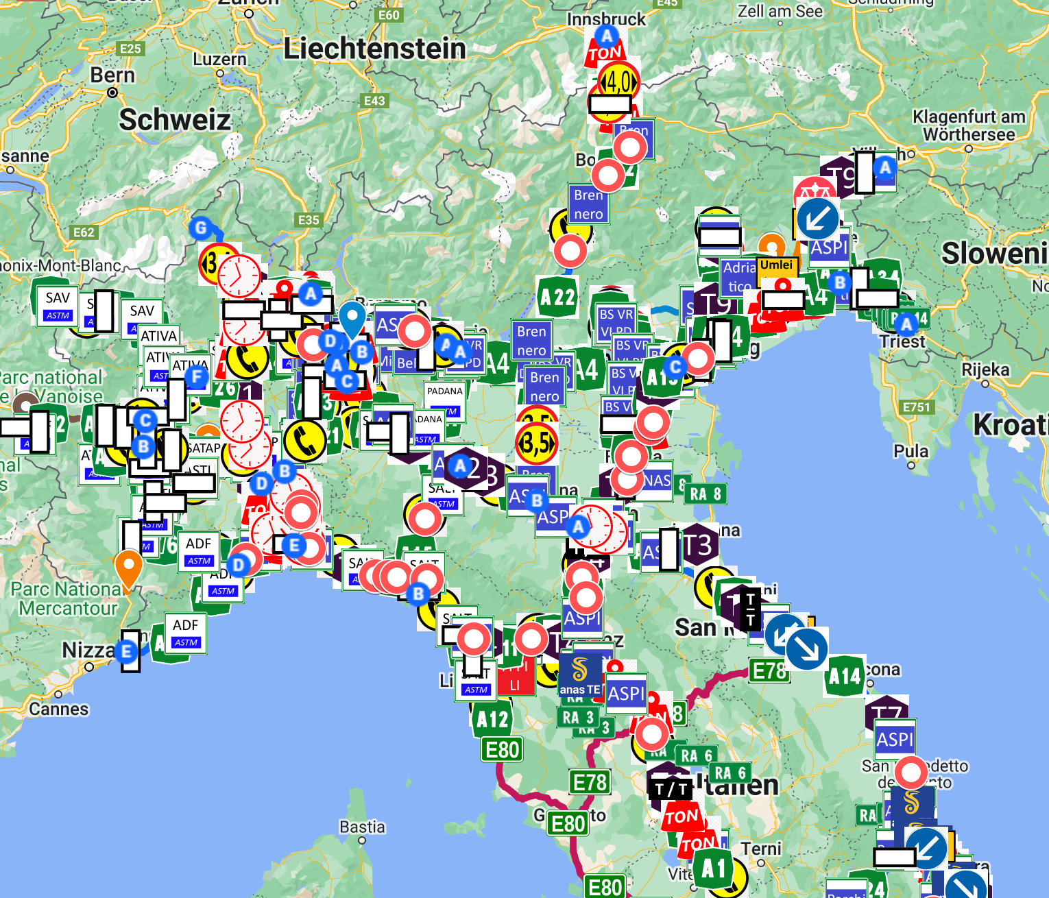
NORTH – ITALY
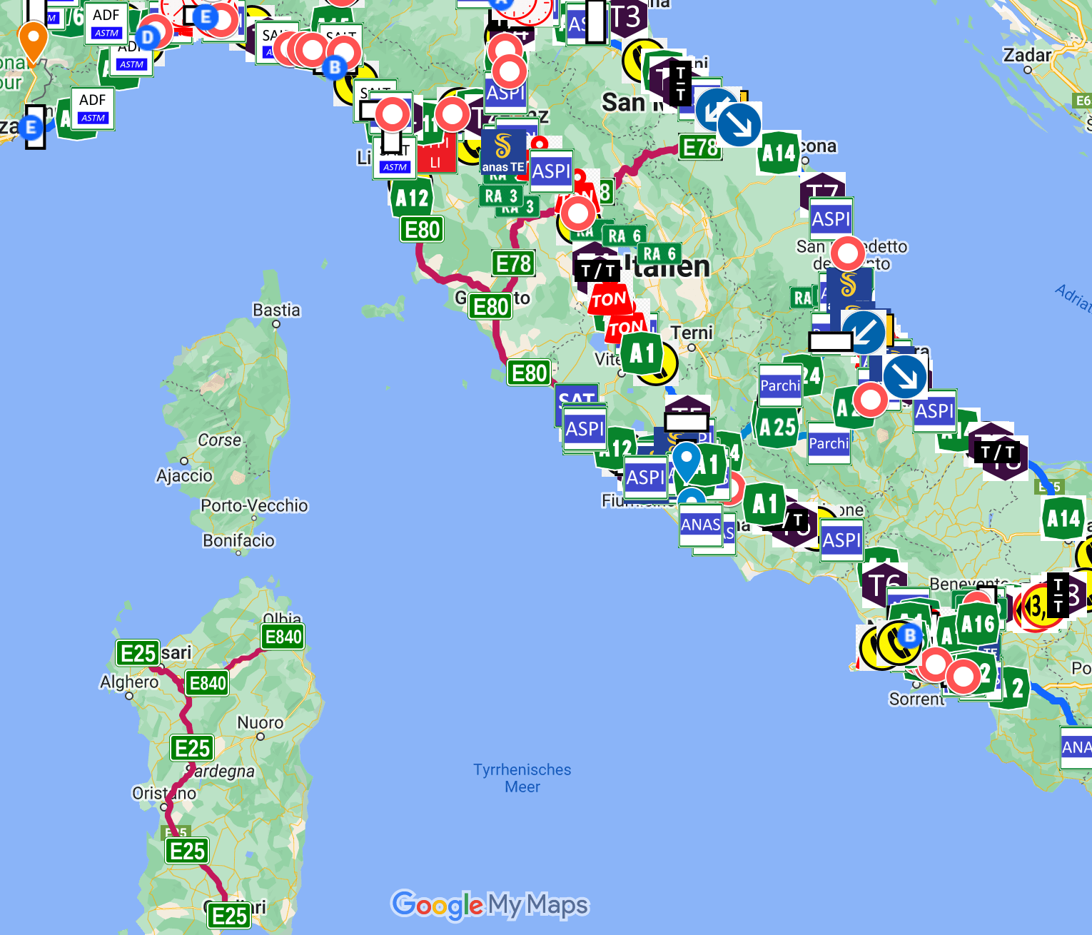
CENTRAL – ITALY
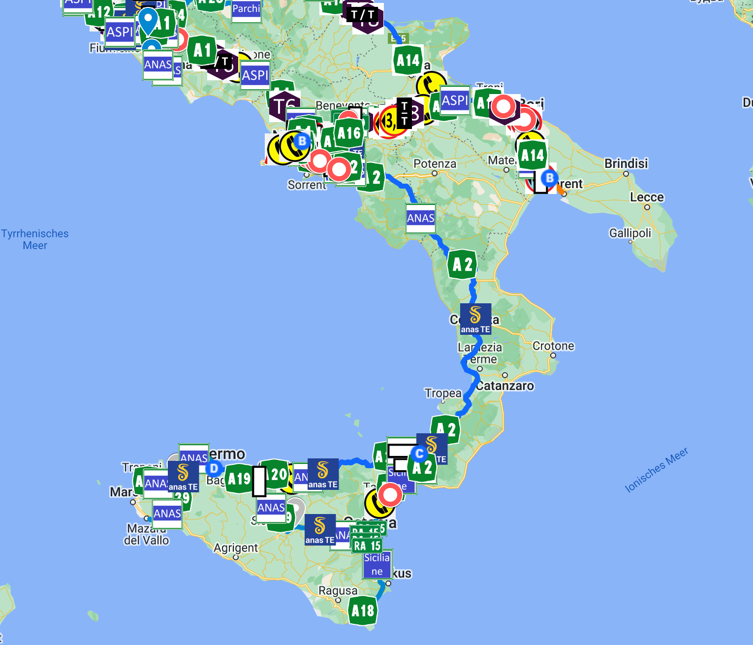
SOUTH – ITALY
The Project Metrans+
Metrans+ is a new geo-information portal and online platform developed exclusively for heavy and oversized transport in Italy, which provides the relevant geographical information and data on the 8,000 km Italian motorway network and the 30 operating companies in order to gain visual geographical knowledge for the planning of heavy and oversized transport.
The 3 digital maps show the user in different levels (Gold – Platinum – Diamond) how the reported construction site information as well as specified bypasses, restrictions regarding height, width and weight, driving bans, motorway driving restrictions, prescribed time windows during day or night, load-restricted bridges and much more are displayed.
Aim of Metrans+ Project
The aim of the Metrans+ project is to realise an innovative and practical use of new technologies such as artificial intelligence bundled in an information system based on a digital map in order to facilitate the process of planning, approving and carrying out large and heavy transports in Italy.
An intelligent map is to be created as a digitally supported assistant for the truck driver, where all relevant navigation information for the route from the point of departure to the destination is displayed and used to optimise and link each step of the process in such a way that all parties involved are relieved and consequently the transport can be carried out faster, safer and more economically while complying with the associated requirements of the permits issued. Professional digital tour preparation is thus available to lorry drivers at the same time.
